Europe is turning grey — faster than official statistics suggest.
For this unprecedented investigation, journalists and scientists from across Europe joined forces to reveal how the continent is quietly losing vast swathes of natural and agricultural land to construction.
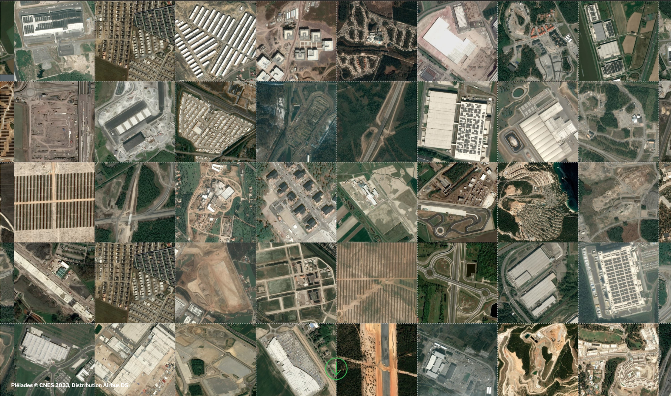
Combining satellite imagery, artificial intelligence and on-the-ground reporting, the Green to Grey project found that around 1,500 square kilometres of “green” land disappear each year, an area roughly the size of London three times over.
Their findings show that land take is up to 50 percent higher than official estimates, largely because most national and EU datasets miss small-scale developments: suburban housing, access roads, parking lots, tourist resorts and industrial estates that nibble away at the edges of nature.
Even protected areas are not immune. The team identified more than 150,000 separate instances of land conversion inside zones that should have been off-limits.
Through striking visuals, interactive maps and case studies from Italy, Portugal, Finland, Turkey and beyond, the investigation shows how Europe’s patchwork of green is being steadily replaced by concrete.
It also highlights the gap between the EU’s ambition of “no net land take by 2050” and the reality on the ground.
The collaboration between 41 journalists and scientists from 11 countries shows the power of cross-border data journalism and environmental science to uncover continental-scale change — one lost meadow, field and forest at a time.
See the stories below.